Story Maps and other Resources

Given the focus of the program to conduct research and science with and for society, Innovator projects have created unique products beyond the more traditional research papers and technical presentations. Below are some highlights.

Innovator Storymaps and other Resources

A Flexible Geospatial Awareness Framework and Tool: Weather Warning Communication and Decision Support

GIS StoryMap, created by Jennifer Boehnert, Kevin Ash, and Christopher Williams, that shows highlights from the Innovators research.

Virtual Reality Video: Resilience Rising Together

Virtual Reality video "Resilience Rising Together" involving Dr. Ajibade's Innovator team.

WRF-FIRE: East Troublesome Wildfire from Granby, CO

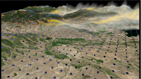
Juliano, T.W., DeCastro, A., Kosovic, B., and Edgeley, C. (2022). WRF-FIRE: East Troublesome Wildfire from Granby, CO. CISL Visualization Gallery, NSF National Center for Atmospheric Research.

Hypoxia: Low Oxygen Events of the Pacific Northwest Coast

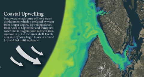
Michala Garrison of University of Oregon won the 2020 Research award for the North American Cartographic Information Society (NACIS)'s student map and poster competition for her project "Hypoxia: Low Oxygen Events of the Pacific Northwest Coast".

Changing Oceans Changing Lives: A Story of an Oregon Fisherman

In Michala Garrison's story map, Changing Ocean, Changing Lives, the viewer is taken through a story of an Oregon Fisherman